Source robotic total station for construction surveying and mapping
Compare 30 robotic total station units from verified Chinese suppliers. Buyers can evaluate accuracy, range, and battery life to find suitable equipment for construction, mapping, and mining applications.
Key considerations
Products List
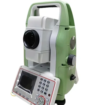
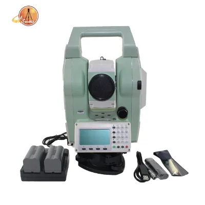
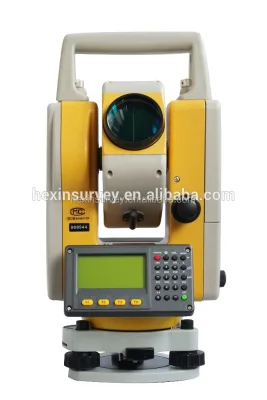
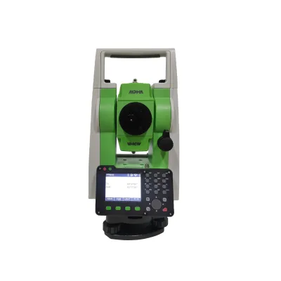
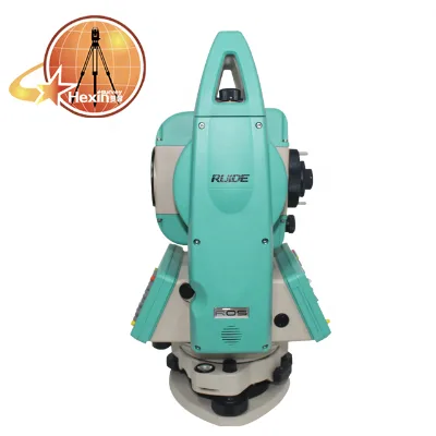
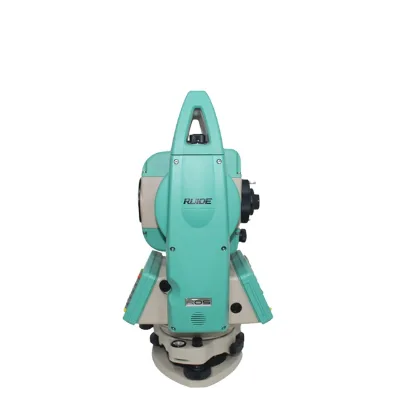


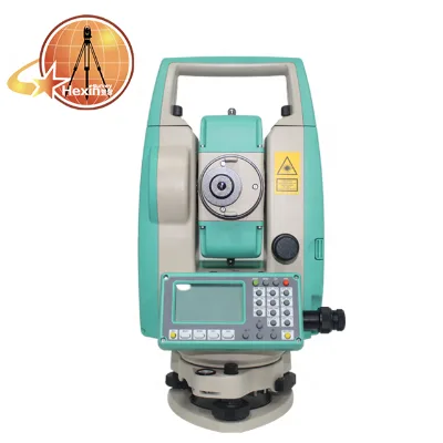


Comprehensive Sourcing Guide
Strategic Sourcing Guide for Robotic Total Stations
Understanding the Core Technology and Operational Scope
The robotic total station represents a significant evolution in surveying instrumentation, integrating automated target recognition with high-precision angle and distance measurement capabilities. For procurement professionals, understanding the fundamental architecture of these devices is the first step in defining accurate technical requirements. These instruments are designed to operate with a robotic telescope that can automatically track and measure a prism or reflectorless target without a human operator at the instrument station. The core functionality relies on a combination of high-resolution encoders, sophisticated compensator systems, and robust communication protocols.
In the current market, the operational scope of these devices varies significantly based on the specific model and intended application. Buyers must distinguish between standard total stations and those explicitly marketed as "robotic." The defining characteristic of a robotic unit is its ability to maintain a lock on a target and adjust its azimuth and zenith angles automatically. This automation is critical for reducing labor costs in large-scale topographic surveys, construction staking, and deformation monitoring. The integration of wireless communication modules, such as Bluetooth and Wi-Fi, allows for real-time data transfer to field controllers, enabling a single operator to manage the entire survey process from the target point.
Technical Specifications and Performance Metrics
When evaluating robotic total stations, procurement teams must scrutinize specific technical parameters that directly impact field performance. The accuracy of angle measurement is a primary differentiator, often expressed in seconds of arc. Market observations indicate that models exist with accuracy ratings ranging from 1.5 seconds to 2 seconds, with some premium units offering 1-second precision. This metric determines the instrument's suitability for high-precision engineering tasks versus general topographic mapping.
Distance measurement capabilities are equally critical and are typically categorized by the method of measurement: prism, reflectorless, or a combination. The maximum range for single-prism measurements can vary widely, with observed specifications including ranges of 2,500 meters, 4,000 meters, and up to 5,000 meters depending on the optical quality and laser power. For reflectorless or non-prism operations, the effective range is generally shorter, with observed capabilities spanning from 600 meters to 1,000 meters, and in some high-end configurations, extending to 2,000 meters. Buyers should verify these figures against their specific project requirements, as environmental conditions such as atmospheric density and target reflectivity can influence actual performance.
The internal sensor technology also plays a vital role in stability. Modern units often feature absolute encoders, which eliminate the need for homing procedures after power cycles, ensuring immediate readiness. Furthermore, the compensator system is essential for maintaining accuracy on uneven terrain. While single-axis liquid tilt sensors are common, dual-axis compensation is increasingly available as an optional or standard feature, allowing the instrument to correct for tilts in both horizontal and vertical planes. The magnification power, typically observed around 30x, and the field of view must be sufficient for the operator to acquire targets quickly, especially in low-light conditions where backlit displays and alphanumeric keyboards become indispensable.
Compliance, Certification, and Regulatory Standards
In the B2B procurement of surveying equipment, verifying compliance with international standards is a non-negotiable step to ensure legal operation and data reliability. While specific certification documents must be requested from the supplier, buyers should be aware of the general regulatory frameworks governing electronic and optical instruments. Instruments intended for commercial use often need to comply with electromagnetic compatibility (EMC) directives, particularly if they utilize wireless communication modules like Bluetooth and Wi-Fi.
Quality assurance protocols should also align with ISO standards relevant to the manufacturing of precision optical instruments. Although specific certification names are not universally standardized across all manufacturers, the presence of a documented quality management system is a strong indicator of product reliability. Buyers must request evidence of calibration traceability to national or international standards. This ensures that the accuracy claims, such as the 1.5" or 2" specifications, are backed by verified test data rather than theoretical calculations. Additionally, for instruments used in specific industries like construction or mining, there may be local regulatory requirements regarding laser safety classes, particularly for the reflectorless distance measurement lasers.
Cost Drivers and Total Cost of Ownership
The pricing structure for robotic total stations is influenced by a complex matrix of factors, including optical quality, automation capabilities, and brand positioning. Observed market data reveals a vast price range, with units listed from approximately 10 USD to 50,000 USD. This disparity reflects the difference between entry-level surveying tools and high-end robotic systems designed for complex, large-scale projects. The cost is not merely a function of the hardware but includes the value of integrated software, communication interfaces, and the durability of the mechanical components.
Beyond the initial purchase price, buyers must consider the total cost of ownership (TCO). This includes the cost of consumables such as batteries, which are often lithium-ion based with capacities around 3000mAh, and the longevity of the instrument under field conditions. Warranty terms, typically ranging from 12 months to 1 year, are a significant cost driver; extended warranty packages can mitigate the financial risk of equipment failure. Furthermore, the supply chain logistics, including packaging details and shipping weights, impact the overall cost. For instance, a robotic total station packaged in a robust case measuring 55cm x 35cm x 45cm with a gross weight of 10kg will incur different shipping costs compared to a lighter, more compact unit.
Typical Applications and Operational Environments
Robotic total stations are versatile tools deployed across a wide spectrum of industries. Their primary application lies in topographic surveying, where the ability to measure distances and angles rapidly is essential for creating detailed maps. In the construction sector, these instruments are indispensable for setting out building grids, monitoring structural deformation, and ensuring precise alignment of infrastructure elements. The "level control" application mentioned in product specifications highlights their utility in civil engineering projects where elevation accuracy is paramount.
The operational environment dictates the specific features required. For outdoor work, the durability of the instrument against dust, moisture, and temperature fluctuations is critical. Features such as dual-axis compensation and robust waterproofing are essential for maintaining performance in adverse weather. The working time of the battery, observed to be up to 25 hours in some configurations, is a key factor for long-duration field operations where access to power is limited. Additionally, the communication capabilities, including support for SD cards, USB, and mini USB interfaces, facilitate data management in remote locations where internet connectivity may be unreliable.
Supplier Evaluation and Quality Control Protocols
Selecting a reliable supplier for robotic total stations requires a rigorous evaluation process that goes beyond price comparisons. Buyers should assess the supplier's supply ability, which can vary from small batches to larger monthly volumes, such as 100 pieces per month. The lead time for delivery is another critical factor; while some suppliers may offer immediate dispatch with a lead time of 4 working days after payment, others may have longer production cycles. The port of dispatch, often Shanghai for manufacturers based in China, influences shipping logistics and import timelines.
Quality control should be a collaborative effort between the buyer and the supplier. Before finalizing a purchase, buyers should request detailed product specifications, including the model number, brand name, and specific technical attributes like the type of keyboard (e.g., double-faced alphanumeric) and display type (backlit). Verification of the single package size and gross weight is necessary for logistics planning. It is also prudent to request sample test results or calibration certificates to validate the accuracy claims. For instance, if a supplier claims a 1.5" accuracy, the buyer should ensure this is supported by independent testing data.
Long-Term Procurement and Strategic Planning
Long-term procurement strategies for robotic total stations must account for the lifecycle of the equipment and the evolving needs of the organization. As technology advances, the integration of new communication standards and software capabilities becomes increasingly important. Buyers should prioritize suppliers who offer a clear path for firmware updates and software compatibility. The warranty period, typically 1 year, should be viewed as a baseline, with plans for extended service contracts to cover the instrument's operational life.
Sustainability and resource management are also emerging considerations. The use of lithium-ion batteries and the recyclability of electronic components should be part of the supplier evaluation criteria. Furthermore, the standardization of equipment across a fleet of instruments can reduce training costs and simplify maintenance procedures. By selecting a consistent brand and model line, organizations can ensure that spare parts and accessories are interchangeable, streamlining the procurement process for future replacements or expansions.
Comparative Analysis of Key Specifications
To facilitate decision-making, the following table summarizes key specifications observed across different robotic total station models. This comparison highlights the variability in performance metrics and helps buyers align their requirements with available options.
| Feature | Model A (Hi-target ATS-320R) | Model B (Alpha Tx) | Model C (Ruide RQS) |
|---|---|---|---|
| Accuracy | Not specified | 1.5" | 2" |
| Single Prism Range | 2500m | 4000m | Not specified |
| Reflectorless Range | 350m | 1000m | 600m |
| Compensator | Single-axis / Dual-axis opt. | Not specified | Dual-axis |
| Battery Life | Not specified | 25 hours | Not specified |
| Communication | RS232 / USB / SD / mini USB | Bluetooth / Wifi / USB | Bluetooth / Wifi |
| Keyboard | 2 sides Alphanumeric | Not specified | Double faces |
| Weight (Gross) | 10kg | Not specified | 12kg |
| Warranty | Not specified | 1 year | 12 months |
| Place of Origin | China | China | China |
This table underscores the importance of matching specific project needs with the correct instrument capabilities. For high-precision tasks requiring 1.5" accuracy, Model B is a strong candidate, while Model C offers a robust dual-axis compensator for unstable terrain. Buyers must carefully weigh these attributes against their budget and operational constraints to make an informed procurement decision.
FAQs
What is the accuracy range for robotic total stations?
Accuracy typically ranges from 1.5 to 2 seconds of arc depending on the model. Premium units like the Alpha Tx offer 1.5 seconds, while others like the Ruide RQS provide 2 seconds for general surveying tasks.
How far can these instruments measure without a prism?
Reflectorless measurement ranges vary from 600 to 1000 meters in standard configurations. Some high-end models extend this capability up to 2000 meters for specific applications requiring non-prism operations.
Which communication interfaces are supported by these devices?
Devices commonly support RS232, USB, SD card, and Bluetooth connectivity. Some models also include Wi-Fi and mini USB ports to facilitate real-time data transfer to field controllers.
Can the compensator system correct for instrument tilt?
Yes, most units feature a single-axis liquid tilt sensor as standard. Dual-axis compensation is often available as an optional feature to correct for tilts in both horizontal and vertical planes.
What is the typical battery working time for these stations?
Working time can reach up to 25 hours on a single charge for certain models. They typically utilize Li-on batteries with capacities around 3000mAh to support long-duration field operations.
Where are these robotic total stations manufactured?
The primary place of origin for these instruments is China, with specific dispatch ports in Shanghai. This location influences shipping logistics and import timelines for international buyers.